NOAA Satellites – Weather maps from space
It’s so fun to track satellites. If you have never tried it, put it on your HAM bucket list. In this post, I give you some info on how to easily do it.
NOAA Satellites are some of my favorites among the best sources of up to date weather forecasts. Understanding weather maps may help you in everyday situations, like figuring out if you need a jacket, a hat, or a scarf on your way to work. The idea is simple, but the equipment needed to receive satellite signals is not trivial.
You’ll need:
- an SDR card, like the Quadrus Platform, in your PC,
- a yagi antenna,
- and an SDR software, e.g., Quadrus SDR software.
The weather in one picture – step by step instructions
I have tested practically all satellite tracking software packages currently available for civilians, and my choice fell on SatPC32. It has been developed by Erich Eichmann, DK1TB, a German ham radio operator and programmer. His excellent software may be used free of charge, although having to put in your geographical coordinates before each start is somewhat uncomfortable. Download here.
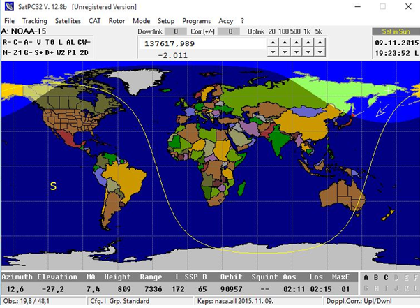
After installing SatPC32, you will see the following:
Altogether 12 satellites can be chosen from the available lists – among them NASA sources. Satellite orbit data can be easily refreshed from http://celestrak.com/NORAD/elements/
There are a number of editable configuration files, among them .sqf files being the most important. The file can be modified by clicking on the question mark in the menu. Notebook starts, and you can see the content of the file plus some advice at the bottom of the ASCII text. Top frequencies for new satellites look like this:
NOAA-15,137620,FM,NOR,0,0
NOAA-18,137912.5,FM,NOR,0,0
NOAA-19,137100,FM,NOR,0,0
These lines contain the name of the satellite, frequency, mode, and some simple notes. After saving this config file, the software will compensate Doppler shift, and reception will be smooth and continuous.
NOAA Automatic Picture Transmission (APT) is an analogue mode. The data coming from the imaging sensors is used to amplitude modulate a 2.4 kHz sub-carrier, which is then used to frequency modulate the VHF carrier at 137.x MHz. The FM deviation is 17 kHz.
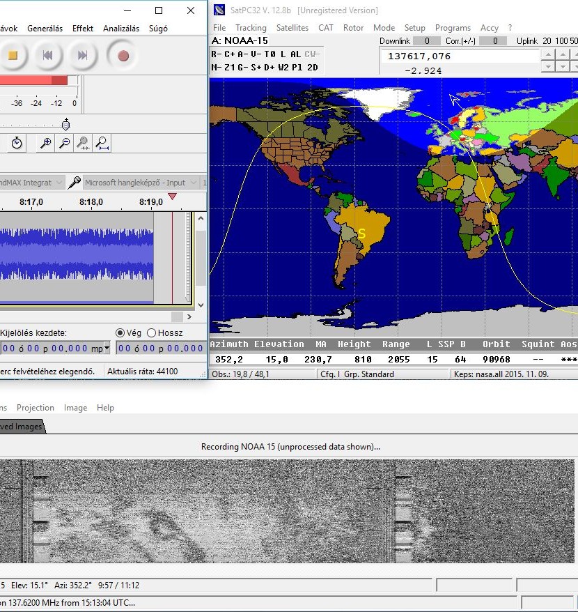
I have heard both NOAA15 and 18 this afternoon (only three NOAA satellites are working). The audio frequency was recorded by Audacity, a well-known software of its kind. A processing software, called WXtoimg, is also needed. Download it from here: http://www.wxtoimg.com/downloads/
A version of WXtoimg may be used for a while, but it costs a few €.
Reception is possible using the well-known yagi antenna even in horizontal positions, although more sophisticated and expensive aerials may be employed as well. More detailed descriptions may be studied at
http://www.astrosurf.com/luxorion/qsl-satellites-reception2.htm
The final outcome of my afternoon weather satellite reception was a map like this:
If you take a fancy to try this small and smart satellite hunting project, please share your outcome maps with me and the Quadrus community!
Have fun!
If you liked this post, check this out:
http://spectrafold.hu/quadrus/radio-software/hunting-for-fm-repeater-frequency/


